“Reader beware as you pass by.
As you are now so once was I.
As I am now so you will be.
Therefore, prepare to follow me.”
–Tombstone Inscription [Source: Pintrest]

This is a true story. It does not involve ghosts but it has potential. It takes place in Owego, NY, my hometown. Yes, it has the elements of a tale that would chill your bones on these chilly nights when the pumpkins line the window sills and the porch steps creak with the frost. The fake spider webs hang from second floor windows and tree branches. The cold wind stirs the red, brown and yellow leaves into dark corners. Candles burn in some windows. Lights are on in the basements of a few dark mansions that line Front Street. The time of year has come to turn up one’s collar, wrap the scarf once more around your neck and pull your hat over your ears.
It’s Halloween and I am trying to find a mausoleum.
When I was a young teenager I often visited the Owego Museum, aka The Tioga County Historical Society. On the wall a large very old map (1853) of Owego hung for years. I used to stand and gaze at the beautiful map, memorizing the names on the plots all over the Village. In the margins are architectural sketches of notable buildings. And here is the problem:
I distinctly remember focusing on the corner of Main and McMaster Streets. There was a rectangle drawn there with the word MAUSOLEUM written in the small box.
On October 20, I was in Owego tending to some business (we were staying at the Parkview Hotel, notably haunted). I dropped in at the Museum to photo the map. I was in for a shock. It wasn’t where I remember it. It wasn’t there. I asked the Director and he led me to an office on the lower floor. There was the map. I slipped out my iPhone and began photographing details of the map. Something was wrong. The mausoleum wasn’t shown. What could have happened? I’m 99.99% sure it was the same map I saw as a boy.

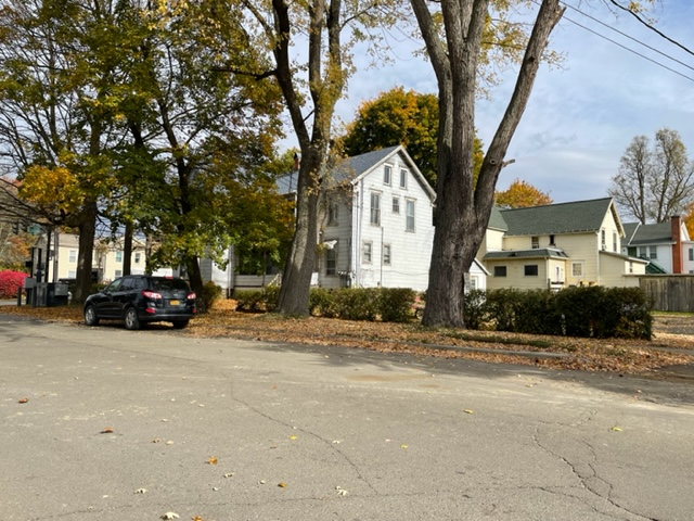
All that is labelled on the corner of Main and McMaster is: Methodist Ch. There is no church on that corner. Here is a photo of the corner:
The mystery is now in place. Was there ever a tomb at this corner? Did I recall the map correctly? If the structure did indeed exist, who was interred there? Where are the hallowed remains now?
I can say this with the utmost confidence, I did see the word MAUSOLEUM on a map at the Owego Museum. I also find it very unlikely that there are two very similar maps. Since so many plots of land has the name Pumpelly on them, it’s likely that the tomb held the remains of a member of that family.
So there it is. Not a very complicated story but certainly a puzzling one.
Putting any potential ghosts aside, I will share something personal with you. It involves the map in question. At the other end of Front Street is the house where I grew up. The address is 420 Front Street.
Interestingly, the map was printed before our house was built.

The view before you is Front Street and part of John Street. This section of Front was long known as “Broken Arm Curve”. It may still have that moniker even though the sharp angle has been modified. As a child, hardly a Saturday night would pass without an accident. (Now there are traffic lights and plenty of warnings of the curve.) Notice the tree icons that appear on several properties. See the large house close to the center of the photo? That was the Hollenback House. Apparently, Hollenback, a successful businessman, had something of a Gentleman’s Farm. Look closely at the angle of Front where it makes a right turn a heads towards the Hickories Park. There is a single tree icon. That is where my house is located. I believe it was built by Hollenback as a wedding present to his daughter. My father bought the house in 1945. After he passed in 2004 we sold 420 Front Street to a young family. That was the Egan house for sixty years.
Now there are only memories of my time playing in the fields that filled the grounds from #420 to the river. There are still live apple trees from Hollenback’s orchards in those yards.
So, while not really a ghost story, this narrative elicits my love of local history…and the very interesting fact concerning a missing crypt.
[All photos are mine. I am grateful for the assistance given to me by Scott MacDonald, Executive Director of the museum and for allowing me to photograph parts of the old Owego map.]
ADDENDUM
Several hours ago (it’s Sunday night) I received a Facebook message from John P. Ricklefs. Attached to his comment was a photo of THE MAP. I am very grateful and glad that the map I saw as a child did indeed exist. Look at the upper left corner of the rectangle. You will see the word Vault. I was not mistaken. But the existence of the vault itself remains a mystery of sorts.


8 responses to “The Lost Mausoleum”
Is the estate the Brick house? I always remember it as Diffendorfers (spelling is wrong)? Trying to get my footing on the map… I grew up down by the Pumpelly house on Front
LikeLike
I believe there is a mausoleum just before the entrance of the Evergreen cemetery on Mountain Ave in Owego.
LikeLike
Apparently he was busy elsewhere so no talk about it
Sent from my iPhone
>
LikeLike
I have the same map. I learn something new about it every once in awhile. I recently learned a little about the canal system that ran down the west side of town. Thanks for sharing.
LikeLike
I’m a writer and researcher who lives in Montrose, Pennyslvania, and I’m currently researching Philip Nunan and his various maps. I’ve discovered only a handful of his maps, and recently came across this map of Owego. He’s made some beautifully detailed maps, but there’s only eight that I’ve been able to locate. The same year, 1853, that he completed this map of Owego, he also completed one of Montrose.
I’m wondering if you might send me a digital copy of the entire map.
LikeLike
I apologize for the delay in responding. The map that I wrote about in the blog hangs on the wall at the Tioga County Historical Society Museum.
I do not have access to any digital maps.
The best to you…
LikeLiked by 1 person
Sorry for the long delay in answering. I don’t know how I could send you a copy. I took the photo from the map as it hung on the wall of the Tioga County Historical Society Museum in Owego. You may want to contact them.
LikeLike
It’s okay. I’ve already had photos of the map sent to me.
LikeLike